Location Of A Signal
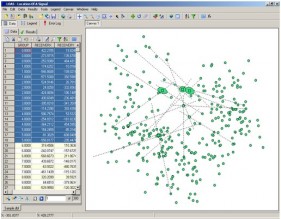
LOAS software is designed to calculate locations from radio telemetry studies. With its combined spreadsheet and GIS interface you will find that LOAS is the easiest to use and most comprehensive radio telemetry software available for Windows®.
|
 |
LOAS also has a variety of export options allowing radio telemetry results to be further analyzed in other software, such as for home range estimates (also see Biotas).
LOAS was mainly created for wildlife radio telemetry studies, but the functions of LOAS can be extended to any system seeking estimated locations from radio telemetry.
Resources:
Download sample file used in above examples.
Back to: Software / Applications
Features:
| Operating System | Windows NT, 2000, XP, 2003 Server, Vista, 7, 8, 10 |
| Maximum File Size | 1 billion records(?)¹ |
| Estimators | Geometric Centroids, MLE, Huber, Andrews |
- Create a lookup list from any field to reduce typing.
- Import file types include txt, dbf, db, mdb (via visual SQL), xls, shp², dxf.
- Open, plot, and analyze more than one bearing set at the same time using the GIS user interface.
- Filter data with simple commands or build complex visual queries from complex multi-table databases (i.e. Access).
- Process all data at once or a selected subset of the data.
- Process 2 or more bearings.
- Create error polygons with biangulations, and error ellipses from bearing sets with more than two bearings.
- Select error ellipse confidence, maximum size, area units, and calculation method.
- Output options include location estimates, interbearing angles, location distances, error polygon/ellipse size, ellipse parameters, actual signal location parameters (if actual locations are known during telemetry tests), etc.
- Automatic fallback methods if MLE fails.
- Create new radio telemetry data files. LOAS has no predetermined field name requirements so you can name your fields what ever you wish (there is a 10 character limit in Dbase files, but not for Paradox, Access, Excel, or text files)
- Enter or edit data directly in the embedded spreadsheet.
- Add user defined fields to the result sheet and export file.
- Export or copy and paste location results to an export file or to other software.
- Select what fields to export.
- Export error ellipse to a GIS compatible file (e.g. shape file).
- Import GIS vector maps of your study site as background coverages².
- Use the GIS interface to add or move receiver locations with the mouse.
- Has a set of simulation functions for testing radio telemetry system parameters.
- And of course, much more.....
¹This is a dBASE record limit, but your available RAM will be the real limit.
²LOAS imports/exports ArcView Shape files
Videos:
Open files, selecting output, selecting and processing data. (Note: This video has no audio. Safe for work environments.)
Importing Background Images. (Note: This video has no audio. Safe for work environments.)